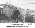
Good Hope NWT and Y station
From RCSigs.ca
| Fort Good Hope NWT and Y Station | |
|---|---|
| Northwest Territories | |
 | |
| Coordinates | |
| In use | 1944 - 1959 |
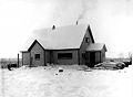
Opened in July 1944 to provide weather information and contacts for boats operating on the MacKenzie River and also to aircraft. Handed over to the Department of Transport on 15 August 1959.
Related Pages
- No related pages at this time
Related Items
NWTandY U 112
Nwtandy ks 4
Nwtandy ks 5

Nwtandy ks 6
Nwtandy ks 7
Station Fort Good Hope 1945


| ||||||||